SERVICE
High-resolution Seafloor Topology
and Geology
Environmental Research Equipment
[ Contact Us ]
03-5820-1181
Offshore Waters Research
High-resolution Seafloor Topology and Geology
Seafloor Topology
High-resolution seafloor research includes deep water topology profiling, wide-area seafloor resource exploration, and submarine cable route design.
The multibeam sonar fit out the bottom of each R/V, the Kaiyo Maru No.1,
No.3 and No.7 provides high-resolution data about the seafloor topology in the depth of 10m to 11,000m for use in various marine projects.
In addition, the echo sounding machine provides hydroacoustic data which is used to identify acoustic anomaly caused by a plume rising from the ocean basin.
The reflected sound pressure can be used to get a simple distribution of bottom sediments.
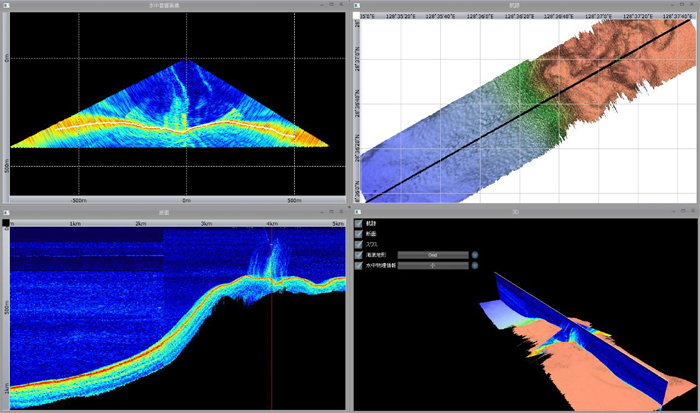
Data taken by the echo sounding machine may be used to create a bathymetric image,
a bird’s eye view, a reflected sound pressure diagram, acoustic anomaly diagram, seafloor gradient map, etc.
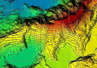
Bathymetric image of a 4000m deep seamount with a laid-over bird’s eye view
Reflected sound pressure diagram
Analytical view showing acoustic anomaly
Fleet of Research Vessels
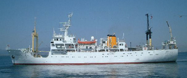
Kaiyo Maru No. 1 fitted
with EM 122 (10~11,000m deep) SBP-120
with EM 122 (10~11,000m deep) SBP-120
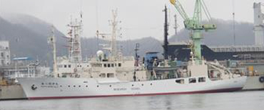
Kaiyo Maru No. 3 fitted
with EM 710MK Ⅱ (10~2,500m deep)
with EM 710MK Ⅱ (10~2,500m deep)
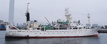
Kaiyo Maru No. 7 fitted
with EM 302 (10~7,000m deep) TOPAS (PS 18)
with EM 302 (10~7,000m deep) TOPAS (PS 18)
Seafloor Geological Research
Geological data are used in wide-area seafloor resource exploration and submarine cable route design.
The sub-bottom profiler (TOPAS PS 18 and SBP 120) at the bottom of each R/V,
the Kaiyo Maru No.1 and No.7 provides sediment structures of some 50m sub-bottom in 11,000m or shallower waters.
The combined side-scan sonar and sub-bottom profiler system (2000-DSS), towed from research vessels,
can be used to create a seafloor image and high-resolution records of geological formation.
Data taken from seafloor geological research are used to create an isopach map, sectional view of surficial sediment, bottom sediment profiling, etc.
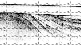
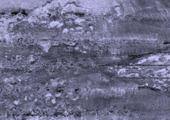
Chart taken by sub-bottom profiler
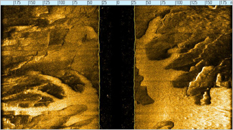
Chart taken by side-scan sonar (2000-DSS)
Environmental Research Equipment
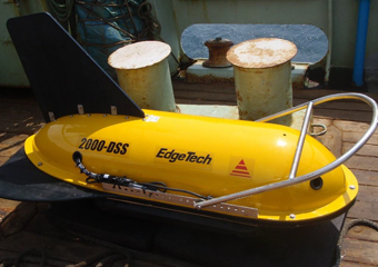
2000DSS
Submarine Cable Route Design
Submarine cable route survey can be conducted in all waters (up to 11000m) in the world. Work starts with submarine cable route planning on DTS (Desk Top Study) using existing documents.
This is followed by land survey to gain topological and other information about the potential land-based station using GPS and total stations.
A submersible survey is conducted next to by divers to gain information about the topology of shallow waters and seabed thickness and commercialization along the planned route.
Video images are also taken to prepare basic data needed for deciding the route.
A marine research is conducted on research vessels with the help of multibeam sonar, sub-bottom profiler,
side-scan sonar and bottom samplers to gain critical data needed for selecting a cable route.
Data analysis is done aboard the vessel and maps are created accordingly as reference material for cable route design.

Topographical survey near shoreline
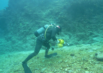
Magnetism survey by a diver
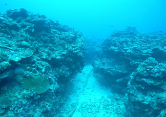
Existing cable in shallow waters
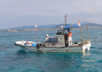
Topographical survey from a boat

Seafloor survey from a vessel